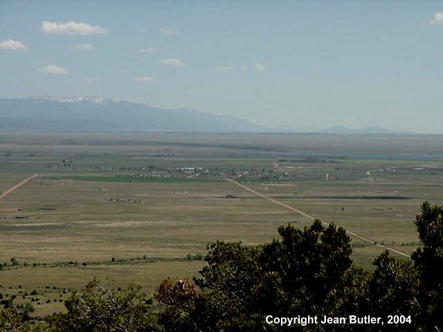
View from Mount Blanca
Blanca covers 1.75 square miles. The platted town extends beyond the edges of the picture and runs 1.75 miles east to west and 1.0 mile north to south. The main inhabited lots, however, comprise only about 3 blocks in the east-west direction between Weaver Avenue and Savage Avenue and about 12 blocks in the north-south direction.
The east end of Smith Reservior can be seen on the right edge of the picture just above the grove of trees.
This picture was taken from 5 miles north of Blanca at an elevation of about 8700 feet with 16 times magnification. At this magnification, only the main three east-west blocks (totaling 3/8 mile) can be seen. In the north-south direction, the 16 blocks of the Town (totaling 1 mile) seem compressed. The large white building on the south side of Town is Blanfort, Inc., the potato packing plant which covers nearly three city blocks.

This photo was taken without magnification from the same point on the slopes of Mt. Blanca.